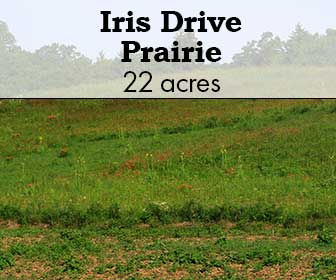
Iris Drive Prairie

Iris Drive Prairie

Iris Drive

This 107-acre site includes approximately 20 acres of remnant prairie located on south facing slopes. The site is located in central Crawford County, WI in the lower Kickapoo River Valley. The area is known as an important bird area that is contiguous to the Lower Wisconsin River Way several miles to the south.


Iris Drive in summer. Photo by Gary Eldred.

Iris Drive

Iris Drive in summer. Photo by Gary Eldred. 

This 107-acre site includes approximately 20 acres of remnant prairie located on south facing slopes. The site is located in central Crawford County, WI in the lower Kickapoo River Valley. The area is known as an important bird area that is contiguous to the Lower Wisconsin River Way several miles to the south.

Access & Directions

The address for the site is 18663 West River Road, Gays Mills, WI 54631. From the village of Gays Mills, WI drive west on HW 171. As you cross the Kickapoo River take the immediate next left onto River Road. Continue south for 2 miles to Iris Drive on your right. You have now arrived at the property. The rural route number is posted along River Road a few hundred feet south of the intersection. To access the prairies, turn right onto Iris Drive and continue for 1,000 feet. There is a farm lane entrance on your right that you can turn into and park off of the road. As you walk north on the farm lane, the eastern prairie that has been restored since 2012 is on your right, and the western prairie that has been restored since 2016 is on your left.

Google Map

Site Steward

Connect with the site steward to see how you can care for this rare habitat at an upcoming work party.

This site is stewarded by The Prairie Enthusiasts Southwest Wisconsin Chapter.

Site Steward: Bob Retko: (262) 384-0081 or (Email)

Upcoming Events Here
How to Enjoy This Site

Allowed:

  • Hunting
  • Fishing
  • Trapping
  • Canoeing
  • Outdoor Recreation

    Not Allowed:

    • Collecting plants, rocks or animals without permission from The Prairie Enthusiasts

    How to Enjoy This Site

    Allowed:

    • Hunting
    • Fishing
    • Trapping
    • Canoeing
    • Outdoor Recreation

      Not Allowed:

      • Collecting plants, rocks or animals without permission from The Prairie Enthusiasts


      View of Iris Drive looking up the hill. Photo by Gary Eldred.

      What Makes Iris Drive Special

      The property is approximately 4 miles north of the Hogsback Prairie, owned by The Nature Conservancy and a WI dedicated State Natural Area. Adjacent to Iris Drive to the east is the WI DNR’s lower Kickapoo Wildlife Area, and 0.5 miles to the north is Mississippi Valley Conservancy’s Kickapoo Bottoms property.

      The lower Kickapoo River valley and its tributaries contain numerous south facing slopes that house many high quality hill prairie remnants. Most of these are privately owned and are so steep and bare that they continue to host a diverse amount native species that are present amongst the scattered cedar and prostrate juniper.

      The property also includes a northern sloped forest that includes some limestone outcropping and a good cover of mature oak species. East of River Road the property fronts along the Kickapoo River for a 0.5 miles.

      The best times to visit and see wildflowers are spring and late summer. In early May, there is a large population of puccoons, violets, sand cress and some cream baptisia. Later in autumn you can see all the tall grasses, nine kinds of asters, five species of goldenrods, gentians and blazing stars. The main remnant area has been cleared by local volunteers. Prior to restoration efforts, nearly 80% of the area was covered with raspberries, honeysuckle and sumac.

      There are currently populations of conservative uncommon species characteristic of dry-mesic to mesic prairie, including, cream indigo, white prairie clover, butterfly milkweed, compass plant, leadplants, and New Jersey tea. Purple Milkweed has been observed in the past, and it is anticipated that with more active management and inventorying that more rare species will be observed. Insect and bird inventories have not been conducted.

      Either the Swenson Hill or nearby Drakenburg prairie were included in the description and analysis of dry-mesic prairies in John Curtis’s seminal work The Vegetation of Wisconsin (1956).  Notes within the 1990 TNC description of the sites and the St. John’s Complex suggest that Olive Thomson visited these sites in the 1950’s. (Read more about Dr. John and Olive Thomson, premier conservationists, environmental education leaders and naturalists.)

      Glimpse of the slope at Iris Drive. Photo by Dan Carter.

      How was Iris Drive Protected

      In 2012, founding member of The Prairie Enthusiasts, Gary Eldred, discovered the prairie remnant. He contacted the previous property owner who lived out of state and by that fall, he developed a working relationship with the original owner of the site who agreed to allow Gary to begin managing the property.

      The property was purchased by The Prairie Enthusiasts in June of 2016 with funds from the WI DNR Knowles Nelson Stewardship Program. The property already had a public hunting and fishing easement placed on the property in the 1960’s.

      Since 2012, Southwest Wisconsin Chapter volunteers have cleared all the remnant prairie present and have continued to work on a regular basis.

      Prairie Enthusiasts pause on a prairie field trip at Iris Drive. Photo by unknown photographer.

      How You Can Help Iris Drive

      Since acquiring the property, volunteers have been clearing brush, treating re-sprouts, and conducting prescribed burns.

      Management efforts by the Southwest Wisconsin Chapter are spearheaded by Gary Eldred and Site Steward Bob Retko. A group of volunteers meet 2-4 times per month to manage the property. Since the site was discovered, the eastern remnant was the first area to be cleared of encroaching trees and brush. Follow-up mowing and herbicide application of re-sprouts have significantly begun to diminish the brush, and with regular prescribed burns, the remnant is beginning to respond.

      Check out our Events Calendar to see upcoming work parties or contact the site steward to get involved.

      Southwest Wisconsin Chapter volunteers spread seed at Iris Drive at a work party. Photo by Kay Wienke.
      Iltis Savanna

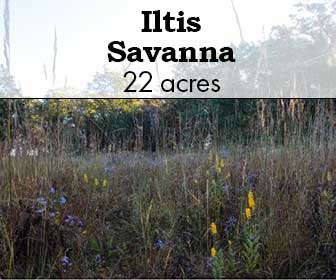
      Iltis Savanna

      Iltis Savanna

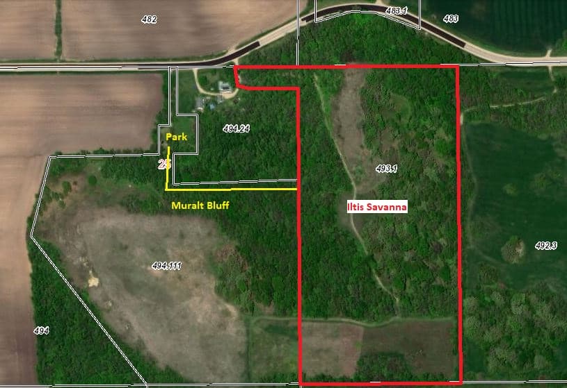
      This site is a 21.5 acre complex of woods, savanna and dry prairie that is adjacent to Muralt Bluff Prairie in the southeast quarter of Section 25 of Mt. Pleasant Township in Green County, Wisconsin.


      Walking through Iltis Savanna. Photo by Rob Baller.

      Iltis Savanna

      Walking through Iltis Savanna. Photo by Rob Baller. 

      This site is a 21.5 acre complex of woods, savanna and dry prairie that is adjacent to Muralt Bluff Prairie in the southeast quarter of Section 25 of Mt. Pleasant Township in Green County, Wisconsin.

      Access & Directions

      Public access to Iltis Savanna is from the parking lot of Muralt Bluff, next to W2635 County F, between Monticello and Albany. Take the hiking path up the steep bluff to the top of the hill, and then walk east toward the oak trees.

      Google Map

      Site Steward

      Connect with the Chapter to see how you can care for this rare habitat at an upcoming work party.

      This site is stewarded by The Prairie Enthusiasts Prairie Bluff Chapter.

      Chapter Contact: (Email)

      Upcoming Events Here

      No event found!

      How to Enjoy This Site

      Allowed:

      • Hiking – steep terrain with no trails
      • Outdoor Recreation
      • Hunting (see below for further information)

      Not Allowed:

      • Collecting plants, animals or other natural materials

      How to Enjoy This Site

      Allowed:

      • Hiking – steep terrain with no trails
      • Outdoor Recreation
      • Hunting (see below for more information)

      Not Allowed:

      • Collecting plants, animals or other natural materials


        Prairie bloom on Iltis Savanna. Photo by David Hamel.

        What Makes Iltis Savanna Special

        This site was the most degraded of our sites upon acquisition, and it remains the most challenging. An aerial photo from 1939 shows a mostly open landscape, with so few open-grown oaks that they can be counted. Our fire regime has promoted the emergence of young oaks, to ensure that this savanna will endure into the 21st century. After significant efforts by members of the Prairie Bluff Chapter, native species are returning.

        Notable Plants

        • Various specis of Rubus
        • joe-pye weed (Eutrochium maculatum)
        • hyssop
        • shooting star
        • bush clover
        • various asters & goldenrod
        • showy orchid (Galearis spectabilis)
        • Indian pipe (Monotropa uniflora)
        • little bluestem (Schizachyrium scoparium)
        • prairie dropseed (Sporobolus heterolepis)
        • lead plant (Amorpha canescens)
        • Hill’s thistle (Cirsium pumilum var. hillii)
        • wood betony (Pedicularis canadensis)
        • bird’s foot violet (Viola pedata)
        • prairie violet (Viola pedatifida)
        • Ohio spiderwort (Tradescantia ohiensis)
        • violet wood sorrel (Oxalis violacea)

        Sun over Iltis Savanna. Photo by Jerry Newman.

        How was Iltis Savanna Protected

        This site was purchased by The Prairie Enthusiasts in December, 1999, and it is named for Dr. Hugh H. Iltis, eminent Professor of Botany at the University of Wisconsin – Madison and Director of the UW Herbarium from 1955 to 1993.

        Looking at the plant life at Iltis Savanna. Photo by Rob Baller.

        How You Can Help Iltis Savanna

        South of these oaks is a 4-acre former agricultural crop field that included a large sumac clone and a honey locust grove when we re-started active management in 2009. We used timed — twice in late summer — mowing to reduce the sumac to manageable numbers, which we then eliminated one-by-one. We hired a contractor in 2016 to uproot the locusts, which we piled and burned.  See our Facebook page for a video, “One more acre for prairie.” We began planting this field to prairie in 2014 with seeds we collected at our other sites, with three subsequent plantings. Site preparation has been difficult due to deep-rooted brome grass and a seed bank of red clover.

        As you walk east along the north edge of this field, the unmanaged woodlot to your left in an example of what happens when grazing animals are removed from a farmstead that has a few oak trees. Walnuts, hickories, cherries, cedars and basswoods eventually grow up, and the understory is filled in with raspberries, blackberries, dogwood, sumac, prickly ash and honeysuckle … lots of honeysuckle.

        The core of Iltis Savanna is a mature bur, white and red oak savanna that occupies a north-south ridge with a thin limestone cap over sandstone. The oak structure remains, but 100 years of grazing by cows, pigs and horses eliminated almost all the floral element underneath. Some sedges and spring ephemerals like trout lily were all that remained under the oaks.  Garlic mustard was a problem that we’ve controlled with prescribed fire. We thinned out the northern portion with a basswood harvest. Various species of Rubus quickly filled these open spaces, while hog peanut moved in to cover the south end with a blanket of vines. But slowly, in the past decade, we’ve seen the natives begin to reclaim the savanna: joe pye weed, hyssop, shooting stars, bush clover, asters and goldenrods. Showy orchids and Indian pipe can be seen most years.

        A keen eye will make out a former farm dump on the side of the bluff, halfway down the hill. For ten years the Chapter worked to clean out the trash: recycling fence wire and hauling off parts of cars, trucks, farm equipment, household appliances, toys, cans, bottles and broken glass. Finally, in 2012, we hired a contractor to bury what was left of the dump.  There was not enough topsoil to cover it all, so a few truckloads of fill were brought in. We began to plant dry prairie species — little bluestem, dropseed and lead plant — into the thin soil. Hill’s thistle and wood betony are now common in this planting.  But the fill contained reed canary grass and the sweet clovers, which were problematic in the lower portion.

        Below the dump planting is a steep west-facing bluff. Restoration started at the top, clearing cedars and brush and seeding in native grasses and forbs. Between this bluff and the savanna is a strip of dry prairie dominated by little bluestem, with both bird’s foot and prairie violet, spiderwort, violet wood sorrel, asters, goldenrods and blazing stars.

        Check out our Events Calendar to see upcoming work parties or contact the site steward to get involved.

        Prairie Bluff Chapter burn crew members manage a burn at Iltis Savanna. Photo by Steve Hubner.

        Hunting Information

        Iltis Savanna 

        Location: Green County, Wisconsin, T3N/R8E
        Habitat: Oak savanna and woodland
        Species that may be hunted: All legal species
        Permit Details: No permit or reservation is required

        Hauser Road Prairie

        Hauser Road Prairie

        Hauser Road Prairie

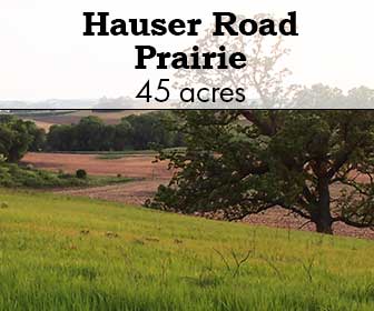
        Located just north of Waunakee, WI, this 45-acre site is the largest remaining single piece of the original 100-square mile Empire Prairie that once covered much of what is now northern Dane County and southern Columbia County. The site’s ridge top hill has many areas of shallow soil over dolomite bedrock, and the abundance of glacially-deposited boulders prevented it from being tilled; it was lightly grazed for 100 years until the 1990’s. Hauser Road Prairie is only 15 miles from downtown Madison, and has the unusual feature for a prairie remnant—a view of the Wisconsin state capitol from the hilltop! This is an important natural feature in a rapidly developing area.


        Exploring Hauser Road Prairie in the summer. Photo by Rob Baller.

        Hauser Road Prairie

        Exploring Hauser Road Prairie in the summer. Photo by Rob Baller.

        Located just north of Waunakee, WI, this 45-acre site is the largest remaining single piece of the original 100-square mile Empire Prairie that once covered much of what is now northern Dane County and southern Columbia County. The site’s ridge top hill has many areas of shallow soil over dolomite bedrock, and the abundance of glacially-deposited boulders prevented it from being tilled; it was lightly grazed for 100 years until the 1990’s. Hauser Road Prairie is only 15 miles from downtown Madison, and has the unusual feature for a prairie remnant—a view of the Wisconsin state capitol from the hilltop! This is an important natural feature in a rapidly developing area.

        Access & Directions

        Hauser Road Prairie is located 4 miles north of Waunakee, WI on the south side of Hauser Road. From the junction of Hwys 19 and 113 in Waunakee, take Hwy 113 north 2.5 miles to Madigan Road (right turn), follow Madigan Road for 1 mile to Hauser Road, turn right. Site is 0.2 miles on the right. Park along the road well off the pavement.

        Google Map

        Site Steward

        Connect with the site steward to see how you can care for this rare habitat at an upcoming work party.

        Site Steward: Randy Hoffman: (608) 849-4502 or (Email)

        Upcoming Events Here

        No event found!

        How to Enjoy This Site

        Allowed:

        • Walking
        • Bird watching
        • Hunting  (see information below)
        • Cross country skiing

          Not Allowed:

          • Bicycles or vehicles
          • Pets
          • Campfires
          • Collection of seed, flowers, plants or the removal of rocks or other natural objects

          How to Enjoy This Site

          Allowed:

          • Walking
          • Bird watching
          • Hunting (see below for more information)
          • Cross country skiing

            Not Allowed:

            • Bicycles or vehicles
            • Pets
            • Campfires
            • Collection of seed, flowers, plants or the removal of rocks or other natural objects


            Taking in the view of Hauser Road Prairie. Photo by Rob Baller.

            What Makes Hauser Road Prairie Special

            A total of 148 prairie plant species have been found on site so far. Some prairie plants sensitive to grazing apparently survived in a narrow strip between the plow line and the fence or as very rare, scattered individuals in some cases. Over the past 30 years these rarities are starting to recolonize the former pasture. They include prairie phlox, leadplant, compass plant, rosinweed, rattlesnake master, and prairie blazingstar. For more details, read the article “Hauser Road Prairie Now Under TPE Care and Protection” by Rich Henderson in the March 2016 issue of The Prairie Promoter.

            There are also populations of two state-threatened plants, ten species of specialized leafhoppers found only on prairie remnants, as well as badgers and an array of grassland birds.

            Notable Plants

            • shooting star
            • pasqueflower (Anemone patens)
            • prairie violet (Viola pedatifida)
            • birdfoot violet (Viola pedata)
            • prairie smoke (Geum triflorum)
            • cylindrical (dwarf) blazingstar (Liatris cylindracea)
            • showy goldenrod (Solidago speciosa)
            • stiff gentian (Gentianella quinquefolia)
            • prairie gentian (Gentiana puberulenta)
            • purple prairie clover (Dalea purpurea)
            • prairie gentian (Gentiana puberulenta)
            • stiff gentian (Gentianella quinquefolia)
            • Hill’s Thistle (Cirsium hillii) – state-threatened
            • edible valerian (Valeriana edulis)
            • smooth white lettuce (Prenanthes alba)
            • heart-leaved golden Alexander (Zizia aptera)
            • and various goldenrods and asters

            Strawberry moon over Hauser Road Prairie. Photo by Kurt Westbrook.

            How was Hauser Road Prairie Protected

            In July of 2014, The Prairie Enthusiasts took on the ownership, care, and management of Hauser Road Prairie. With grants from the Wisconsin DNR Knowles-Nelson Stewardship Program and the Dane County Conservation Fund and a loan from The Conservation Fund (a national non-profit), The Prairie Enthusiasts acquired title to this impressive big sky ridge of natural heritage.
             
            The permanent protection of Hauser Road Prairie was the culmination of 22 years of effort by The Prairie Enthusiasts and the Wisconsin Department of Natural Resources (WIDNR) Natural Areas Program. In the early 1980s, the conservation community became aware that prairie was surviving in the 45-acre pasture along Hauser Road. In 1992, The Prairie Enthusiasts volunteers reached out to the new owners of the site to inform them of the treasure they had and offered advice, help and encouragement in conserving the site. From 2000 to 2014, the Natural Areas Program leased the land and conducted several prescribed burns and some brush control. The Prairie Enthusiasts also mowed sweet clover and provided other weed control measures during this time.

            In 2013, the owners, Mike and Susan Zauner, decided they would like the site permanently protected. The Natural Areas program negotiated with them to buy the site and to designate it a State Natural Area, but the project was not accepted by the WI DNR administration. The Prairie Enthusiasts offered to step in and acquire the site by applying for grants from Knowles-Nelson Stewardship Program and the Dane County Conservation Fund, which covered three-quarters of the acquisition expenses. The Prairie Enthusiasts was able to pay the remainder thanks to generous donations from members from across the organization. 

            Looking out over Hauser Road Prairie. Photo by Joshua Mayer.

            How You Can Help Hauser Road Prairie

            With a grant from the U.S. Fish & Wildlife Service Private Lands Program and the efforts of site steward Randy Hoffman and other volunteers, great progress has been made at Hauser Road Prairie removing trees and brush from the preserve.

            The years of grazing took its toll on the composition of the prairie vegetation, eliminating some species, reducing others and allowing non-native grasses to invade, especially in the deeper soils areas. However, much of the original prairie ecosystem survived and has been making a good recovery since the cessation of grazing and the implementation of an occasional prescribed burn from 2000 to 2013.

            Fortunately, there are several high-quality small prairie remnants within a few miles of the preserve harboring the full range of prairie species native to the area. Our management goal for Hauser Road Prairie is to bring seed from those remnants to the preserve to accelerate its recovery and to reintroduce lost species such as wood lily, wood betony and rough white lettuce. With burning and inter-seeding, we hope to bring back most, if not all, of the site’s original diverse prairie plant community over the next 30 years.

            Volunteers are vital to the management of this prairie. Join us for a workday on Hauser Road Prairie and the other prairie remnants in the area to collect and plant seed, control weeds and brush, conduct biological monitoring and help with other management activities.

            Check out our Events Calendar to see upcoming work parties or contact the site steward to get involved.

            Prescribed burn at Hauser Road Prairie. Photo by Kevin McKown.

            Hunting Information

            Hauser Road Prairie 

            Location: Dane County, Wisconsin, 3 miles north of Waunakee, on Hauser Road off Madigan Rd
            Habitat: Grassland
            Species that may be hunted: All legal species
            Permit Details: no permit or reservation required

            Hanley Savanna

            Hanley Savanna

            Hanley Savanna


            Sand prairie at Hanley Savanna. Photo by James Quick.

            Hanley Savanna

            Sand prairie at Hanley Savanna. Photo by James Quick. 

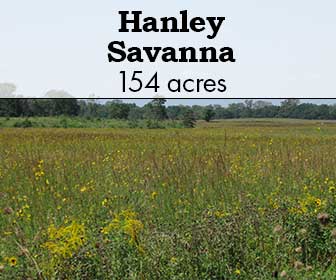
            This site is a 160-acre prairie, savanna and woodland restoration in rural Hanover, IL. This site has transformed from row cropland and white pine plantation to several types of prairie ecosystems, including tall grass prairies, oak savannas, fens, sand blowouts and black oak barrens. The property is relatively flat with mowed trails, making it an easy place to hike.

            Access & Directions

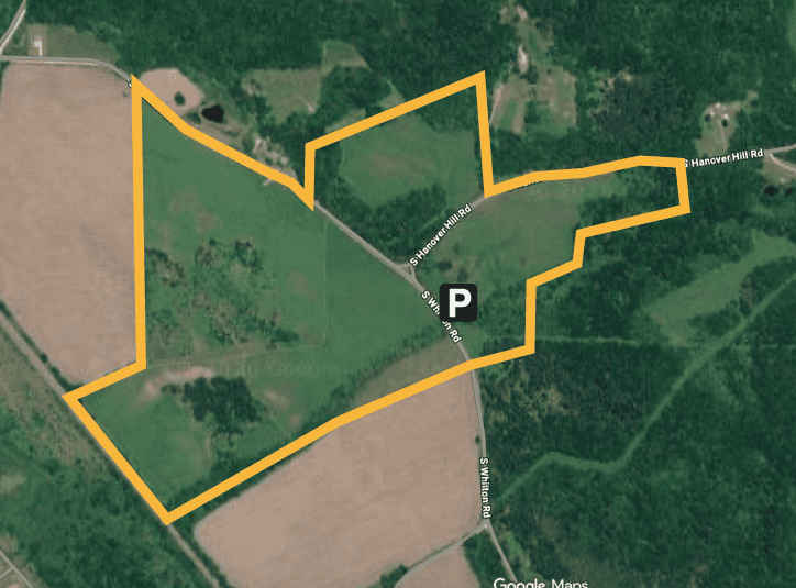
            From Hanover, take Fulton Rd south. Continue onto S. Hanover Hill Rd. Turn left onto South Whitton Rd. There is a building on the left with interpretive signage and explanation of what to see at the site. 

            Google Map

            Site Steward

            Connect with the Chapter to see how you can care for this rare habitat at an upcoming work party.

            This site is stewarded by The Prairie Enthusiasts Northwest Illinois Chapter.

            Upcoming Events Here

            No event found!

            How to Enjoy This Site

            Allowed:

            • Hiking
            • Outdoor recreation

            How to Enjoy This Site

            Allowed:

            • Hiking
            • Outdoor recreation


                Staff and volunteers try to identify bees at Hanley Savanna during a spring field trip. Photo by Cassidy Coulson.

                What Makes Hanley Savanna Special

                Hanley Savanna connects the Lost Mound Unit of the Upper Mississippi River U.S. Fish & Wildlife Refuge with the Illinois Department of Natural Resources’ Hanover Bluff Nature Preserve. Altogether, these and adjoining protected areas create the largest protected area in northwest Illinois – about 11,200 acres – with a wide diversity of natural areas from bluff tops down through the Mississippi River.

                Visitors are welcome at Hanley Savanna. Hiking trails throughout the area allow easy access to observe native prairie and savanna plants as well as a variety of grassland and woodland birds. Interpretive signage at the shelter near the intersection of Whitton and Hanover Hill Roads provides details about the history of Hanley Savanna, information about prairies, and a trail map.

                Wood betony at Hanley Savanna. Photo by Sarah Barron.

                How was Hanley Savanna Protected

                In the early 1970s, Jim Lewis purchased almost 300 acres of land from the top of the bluff to the valley below. His farm, a portion of which would become Hanley Savanna, stretched from the railroad tracks to the bluff top.

                In 2003, The Prairie Enthusiasts purchased 110 acres from Lewis, starting Hanley Savanna. The Prairie Enthusiasts purchased an additional 44 acres of land from farmer Gene Roberts and six additional acres from The Nature Conservancy, completing the current 160 acres of Hanley Savanna.

                Staff members and Northwest Illinois Chapter volunteers look at a bee up close on a field trip at Hanley Savanna. Photo by Sarah Barron.

                How You Can Help Hanley Savanna

                The Northwest Illinois Chapter began undertaking the restoration and management of Hanley Savanna’s prairies and savannas in 2003.

                Check out our Events Calendar to see upcoming work parties or contact the site steward to get involved.

                Following a work party, staff members and volunteers gather at Hanley Savanna’s shelter. Photo by Sarah Barron.

                Handrick Grassland

                Handrick Grassland

                Handrick Grassland


                Lousewort  at Handrick Grassland. Photo by Reid Bartholomew.

                Handrick Grassland

                Lousewort at Handrick Grassland. Photo by Reid Bartholomew. 

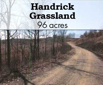
                This rolling, open landscape is prime grassland bird habitat. The site is known for its stunning display of lupines on the sandstone ridges. 

                Access & Directions

                Head south on Co Hwy JG. Turn left onto Britt Valley Rd. Turn right onto Co Rd G. Continue on to Oak Grove Rd. 

                Google Map

                Site Steward

                Connect with the Chapter to see how you can care for this rare habitat at an upcoming work party.

                This site is stewarded by The Prairie Enthusiasts Empire-Sauk Chapter.

                Site Steward: Pat Handrick 

                Upcoming Events Here

                No event found!

                How to Enjoy This Site

                Allowed:

                • Hunting (see below for more information)
                • Hiking
                • Bird-watching
                • Photography

                  Not Allowed:

                  • Collection of plants, wildlife or other natural material

                  How to Enjoy This Site

                  Allowed:

                  • Hunting (see below for more information)
                  • Hiking
                  • Bird-watching
                  • Photography

                    Not Allowed:

                    • Collection of plants, wildlife or other natural material


                    Lupines at Handrick Grassland. Photo by Reid Bartholomew.

                    What Makes Handrick Grassland Special

                    This site  is located within one of three grassland bird conservation areas within the DNR’s Southwest Grassland and Stream Conservation Area, making it a prime place for birders to visit. There is an abundance of native plants across the rolling landscape as well. 

                    Shooting star at Handrick Grassland. Photo by Reid Bartholomew.

                    How was Handrick Grassland Protected

                    The Prairie Enthusiasts protected this site in 2015 after having aided the landowner with prescribed burns for about 15 years.

                    Bumble bee on lousewort at Handrick Grassland. Photo by Reid Bartholomew.

                    How You Can Help Handrick Grassland

                    This site receives regular prescribed burns, along with brush removal.

                    Check out our Events Calendar to see upcoming work parties or contact the site steward to get involved.

                    Prescribed burn at Handrick Grassland. Unknown Photographer.

                    Hunting Information

                    Handrick Grassland 

                    Location: Dane County, Wisconsin
                    Habitat: Grassland (Site Map)
                    Species that may be hunted: All legal species
                    Permit Details: No permit or reservation is required