by The Prairie Enthusiasts | Jul 19, 2023
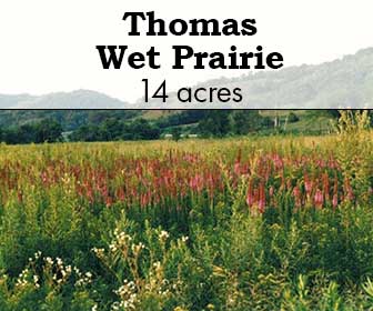
Thomas Wet Prairie
These 13.7 acres preserve wet prairie, sedge meadow, little pools, clumps of willow and a single large bur oak. Biologists have recorded over 200 plant species and scores of insect and spider species. When’s the last time you saw a crayfish tunnel in a prairie? Thomas Wet Prairie is full of them. It also home to a fuzzy-shelled old snapping turtle. Each summer, dozens of sedge wrens and a few snipe nest there. Bald eagles often visit the bur oak.
SITE STEWARDS
KRISTIN WESTAD
ACCESS & DIRECTIONS
Thomas Wet Prairie is located in Grant County on County Trunk Highway G, approximately 7.5 miles south of the village of Muscoda and 8 miles north of the intersection with US Highway 18. 16403 County Road G, Muscoda 53573.
Allowed:
- Hiking
- Hunting (for all species, no permit or reservation required)
For decades, the Thomas family left their cattle in the wet prairie. Far from the barn, and too squishy for easy walking, cattle didn’t graze the land very hard. The Thomas family includes nature lovers. They never installed drain tile or broadcast sprayed the pasture with herbicide the way some farmers might. Their gentle approach to farming sustained the native community.
In the late 1980s, the Prairie Enthusiasts purchased 13.7 acres from the Thomas family with targeted funds from a major donor. Before then, volunteers had explored, documented and managed prairie remnants, but hadn’t acquired any land for permanent protection. At Thomas Wet Prairie, The Prairie Enthusiasts became a landowner for the first time.
Although Thomas Wet Prairie never had the dense brush that threaten many prairies, reed canary grass and hybrid cattails crowd out native species in parts of the preserve. To reduce their abundance, volunteers use a combination of frequent fire and selective herbicide treatment. When burning, volunteers leave half of the land unburned as a refuge for fire-sensitive species. Volunteers spread seeds of native species into the areas where they are removing pest species.
by The Prairie Enthusiasts | Jul 19, 2023
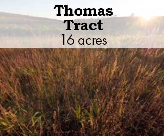
This site is 190 acres of native prairie and agricultural land. Once common in southern Wisconsin, prairies are very rare today. The 95,000-acre Military Ridge Prairie Heritage Area in Dane and Iowa counties contains one of the highest concentrations of native grasslands in the Midwest. It provides important habitat for plants and animals like meadowlarks and other grassland birds, which have disappeared in more developed parts of the region. The federally-endangered prairie bush clover occurs on The Nature Conservancy’s (TNC) land to the south. Because there is similar habitat on The Prairie Enthusiasts’ land, the population of this rare plant is expected to expand as restoration progresses. The adjacent land owned by TNC also has a population of the State Endangered regal fritillary butterfly, we expect it to move on to this portion of land as well, especially as restoration proceeds.
SITE STEWARDS
EMPIRE-SAUK CHAPTER
ACCESS & DIRECTIONS
3975 County T, Barneveld
Allowed:
- Hiking
- Hunting (for all species, no permit or reservation required)
The primary goal is to restore the Thomas land back to its original open prairie, which is important for declining grassland birds and other wildlife. This will be a volunteer effort for the most part, and we welcome new volunteers. In the future, we hope to work with the community and our partners to form a “Friends of the Thomas Stone Barn” group to contribute the knowledge and expertise with historic buildings that we lack, and help make the barn a place where people can gather and experience our prairie and agricultural heritage.
by The Prairie Enthusiasts | Jul 19, 2023
Sylvan Road Conservation Area
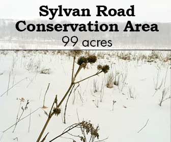
TPE purchased these 99 acres of oak woods, wet prairie, and riparian scrub/young forest in 2014. The wet prairie consists of wet mesic prairie, wet prairie, and sedge meadow. This area is the gem of this parcel and contains a number of species rarely found in Wisconsin, including Rattlesnake master, Yellow-headed fox sedge, and Prairie gray sedge. Prairie Indian plantain, a threatened species, is also found in this community.
SITE STEWARDS
SOUTHWEST CHAPTER
ACCESS & DIRECTIONS
This site is southeast of Dodgeville along Sylvan and Banner Roads in the Town of Waldwick.
Allowed:
- Hiking
- Hunting (for all species, no permit or reservation required)
by The Prairie Enthusiasts | Jul 19, 2023
Iris Drive
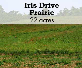
Iris Drive is a site managed by the Southwest Chapter and was found by TPE Director Emeritus Gary Eldred. Starting in the fall of 2012, Gary developed a working relationship with the original owner of the site, who agreed to allow Gary to begin managing the property. The site, which totals 107 acres includes approximately 20 acres of remnant prairie located on south facing slopes. Since 2012, TPE volunteers have cleared all the remnant prairie present and have continued to work on a regular basis.
SITE STEWARD
BOB RETKO
(262) 384-0081
ACCESS & DIRECTIONS
The address for the site is 18663 West River Road, Gays Mills, WI 54631. From the village of Gays Mills, WI drive west on HW 171. As you cross the Kickapoo River take the immediate next left onto River Road. Continue south for 2 miles to Iris Drive on your right. You have now arrived at the property. The rural route number is posted along River Road a few hundred feet south of the intersection. To access the prairies, turn right onto Iris Drive and continue for 1,000 feet. There is a farm lane entrance on your right that you can turn into and park off of the road. As you walk north on the farm lane, the eastern prairie that has been restored since 2012 is on your right, and the western prairie that has been restored since 2016 is on your left.
Description & Significance
Iris Drive is located in central Crawford County, WI in the lower Kickapoo River Valley. The area is known as an important bird area that is contiguous to the Lower Wisconsin River Way several miles to the south. The property is approximately 4 miles north of the Hogsback Prairie, owned by The Nature Conservancy and a WI dedicated State Natural Area. Adjacent to Iris Drive to the east is the WI DNR’s lower Kickapoo Wildlife Area, and 0.5 miles to the north is Mississippi Valley Conservancy’s Kickapoo Bottoms property.
The lower Kickapoo River valley and its tributaries contain numerous south facing slopes that house many high quality hill prairie remnants. Most of these are privately owned and are so steep and bare that they continue to host a diverse amount native species that are present amongst the scattered cedar and prostrate juniper.
The property also includes a northern sloped forest that includes some limestone outcropping and a good cover of mature oak species. East of River Road the property fronts along the Kickapoo River for a 0.5 miles.
The best times to visit and see wildflowers are spring and late summer. In early May, there is a large population of puccoons, violets, sand cress and some cream baptisia. Later in autumn you can see all the tall grasses, nine kinds of asters, five species of goldenrods, gentians and blazing stars. The main remnant area has been cleared by local volunteers. Prior to restoration efforts nearly 80% of the area was covered with raspberries, honeysuckle and sumac.
There are currently populations of conservative uncommon species characteristic of dry-mesic to mesic prairie, including, cream indigo, white prairie clover, butterfly milkweed, compass plant, leadplants, and New Jersey tea. Purple Milkweed has been observed in the past, and it is anticipated that with more active management and inventorying that more rare species will be observed. Insect and bird inventories have not been conducted.
Either the Swenson Hill or nearby Drakenburg prairie were included in the description and analysis of dry-mesic prairies in John Curtis’s seminal work The Vegetation of Wisconsin (1956). Notes within the 1990 TNC description of the sites and the St. John’s Complex suggest that Olive Thomson visited these sites in the 1950’s. (Read more about Dr. John and Olive Thomson, premier conservationists, environmental education leaders and naturalists.)
Allowed:
- Hunting
- Fishing
- Trapping
- Canoeing
- Outdoor Recreation
Not Allowed:
- Collecting plants, rocks or animals without permission from The Prairie Enthusiasts
The property was purchased by TPE in June of 2016 with funds from the WI DNR Knowles Nelson Stewardship Program. The property already had a public hunting and fishing easement placed on the property in the 1960’s. In 2012 Gary Eldred discovered the remnants and contacted the previous owner who lived out of state. Since acquiring the property, volunteers have been clearing brush, treating re-sprouts, and conducting prescribed burns.
Management efforts by the Southwest Chapter are spearheaded by Gary Eldred and Site Steward Bob Retko. A group of volunteers meet 2-4 times per month to manage the property. Interested people should contact Bob Retko by email (retko2001@yahoo.com) or phone (262) 384-0082 to inquire about their next work party. Since the site was discovered, the eastern remnant was the first area to be cleared of encroaching trees and brush. Follow-up mowing and herbicide application of re-sprouts have significantly begun to diminish the brush, and with regular prescribed burns, the remnant is beginning to respond.
by The Prairie Enthusiasts | Jul 19, 2023
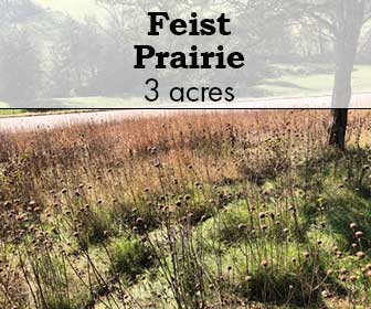
Feist Prairie
Feist Prairie is a 3 acre site with 1 acre of remnant prairie that was purchased in 2013. Although small, it contains a large number of species on land that was never cultivated, pastured, or sprayed. Rare insects have been observed on this site: Goldenrod soldier beetle (Chauliognathus pensylvanicus) and Robber fly (Promachus vertebratus).
Gerald and Patricia Feist, who owned this parcel as part of their larger farm operation, sold this site to the Southwest Chapter after many years of leasing the land. The farm had been in the Feist family since 1875; this site is a wonderful example of a pre-European settlement prairie/savanna community.
Current efforts include removing woody invasives and trees to expand the range of the original remnant.
SITE STEWARDS
BECKY FERNETTE
608-379-0781
ACCESS & DIRECTIONS
From Stitzer, head east on County Rd E. Turn right (south) on Ridge Road, then left (east) on Sleepy Hollow Rd. The prairie is approximately .6 miles on the left.
Allowed:
- Outdoor Recreation
- Hunting (for all species, no permit or reservation required)


