Who We AreSylvie Rising Operations Assistant...
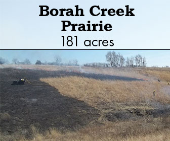
Borah Creek Prairie
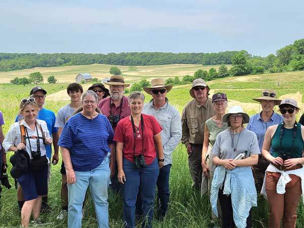
Borah Creek Prairie
In 2009, The Prairie Enthusiasts, Mississippi Valley Conservancy, and Driftless Area Land Conservancy, with funding from the U.S. Fish and Wildlife Service and the WI DNR Knowles-Nelson State Stewardship Fund, procured 138 acres of this site near Fennimore, WI. It was immediately designated a WI State Natural Area. In 2010, title was transferred to The Prairie Enthusiasts. It has since been managed and cared for by TPE. In 2013, another 43 acres were added to the preserve for a total 181. The preserve consist of 10 acres of high quality remnant dry and dry-mesic prairie, 17 acres of former cropland planted to prairie vegetation, and 5 acres of overgrown oak savanna. Most of the rest of the preserve is former pasture with varying amounts of native prairie vegetation that survived the grazing, including a large population of the Federally Endangered prairie bush-clover. Surveys of this property have found such rare prairie specialist as woolly milkweed, prairie Indian-plantain, Hill’s thistle, wild quinine, and prairie turnip. Rare and declining grassland birds detected using the area include upland sandpiper, eastern kingbird, brown thrasher, dickcissel, eastern meadowlark, grasshopper sparrow, and bell’s vireo.
SITE STEWARDS
SOUTHWEST WISCONSIN CHAPTER
ACCESS & DIRECTIONS
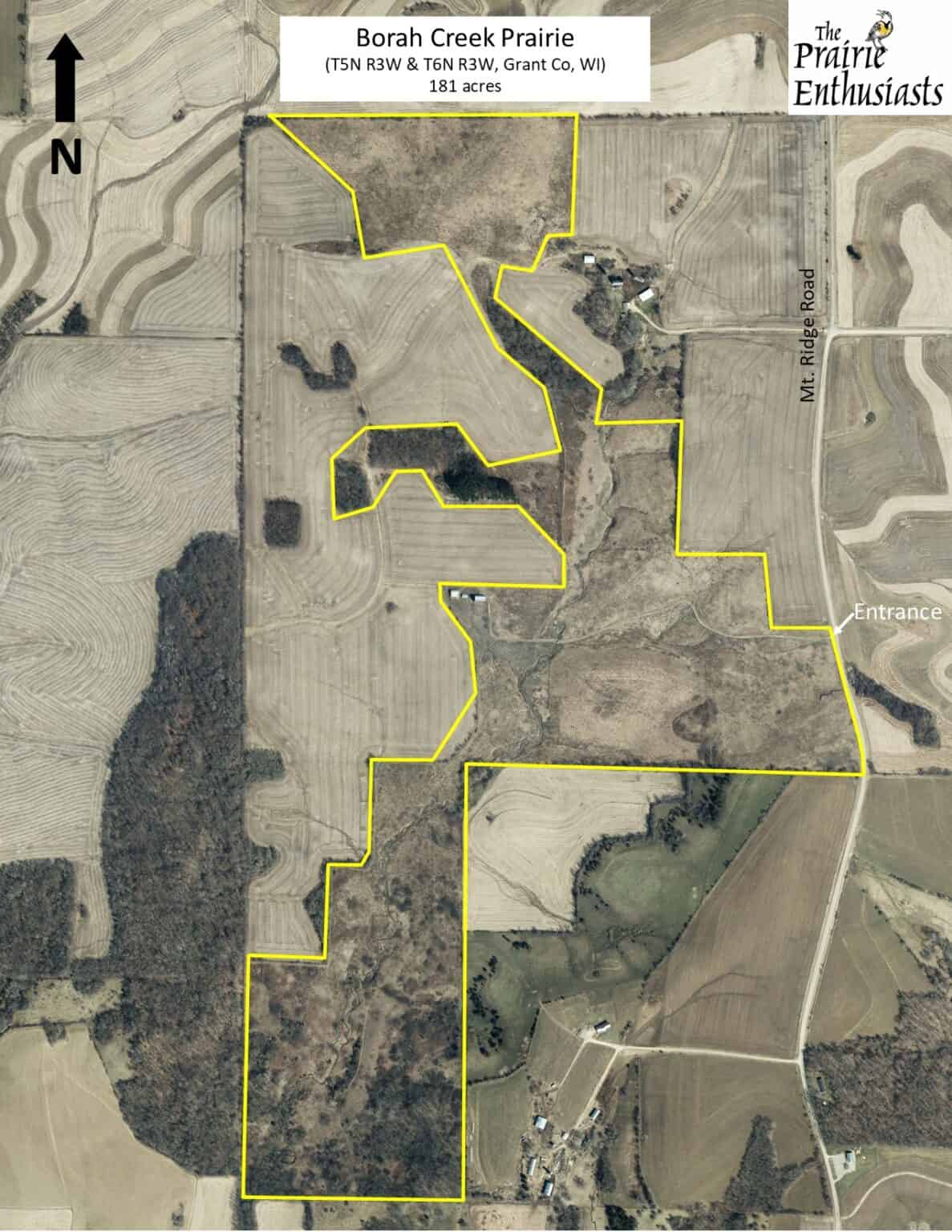
From the west side of Fennimore, head south on Rodger Hollow Road for 2.7 mi. Turn right onto Mt. North Road. Go west for 0.8 miles. Turn right (south) on Mt Ridge Road. Go 1/3 mi to the access road and parking lot to Borah Creek Prairie on the right, at 11949 Mount Ridge Road.
Google Map
Usage Policies
Allowed:
- Outdoor Recreation
- Hunting (for all species, no permit or reservation required)
- Trapping (for all species, no permit or reservation required)
Not Allowed:
- Collecting Plants, Seeds, Rocks or Animals without permission from The Prairie Enthusiasts
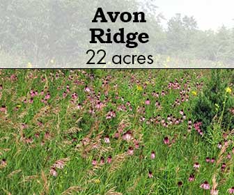
Avon Ridge
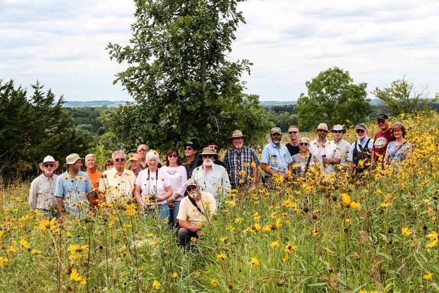
Photo credit: Jerry Newman
Avon Ridge
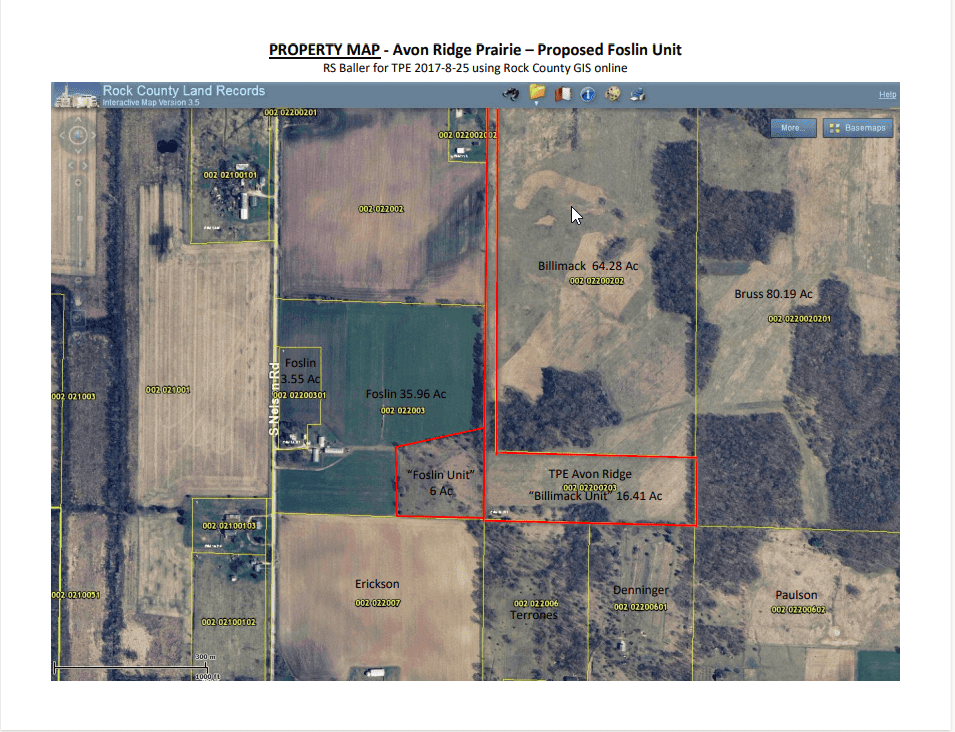
The Prairie Enthusiasts purchased in 2015. It’s a 16.5-acre parcel and features an abundance of rare flowers. The chapter added 5.9 acres with the purchase of Foslin Bluff in 2020, creating a contiguous 22.4-acre site that is open to the public for hiking, birding and hunting (in season). Both the addition and the original 16.5-acre parcel were purchased with funds from the Knowles-Nelson Stewardship Fund of the Wisconsin DNR.
Compass plant (Silphium laciniatum), prairie sunflower (Helianthus pauciflorus), and Carolina rose (Roas carolina) are just some plants commonly found on this scenic spot. This location has a panoramic view southwest over the valley of Sugar River into Illinois. The ridge is part of a complex of mostly riverine grasslands and floodplain forest known as Avon Bottoms.
This property is difficult to walk as there are no trails and the parking lot is quite far from the prairie.
ACCESS & DIRECTIONS
Visitors should park in the small gravel parking lot off Beloit-Newark Road, a half-mile east of Nelson Road, in the Rock County town of Avon, which is west of Beloit and southeast of Brodhead. Take Highway 81 out of Brodhead a few miles and turn south on Nelson Road, then east on Beloit-Newark. The nearest fire number is 15347 W. Beloit-Newark Road for our neighbor to the west. From the parking lot walk south along the fence line, up the hill and over the ridge to the south-facing one-acre prairie. Foslin Bluff is the extension to the west. The original one-acre remnant is over the ridge. To the east is planted prairie, in a 10-year CRP federal contract we inherited from the previous owner. Access is limited to foot traffic only. Camping, picnics, ATVs and horseback riding are not allowed.
Google Map
Natural History
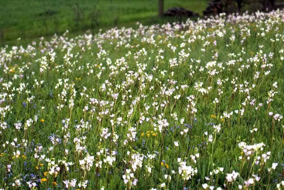
Photo credit: Jerry Newman
Avon Ridge is a composite of one-acre, never plowed and never grazed dry hill prairie, plus unplowed ground to the south and west that is privately-owned but contains similar native grasses and uncommon forbs. The ridge is capped with limestone and underlain by sandstone that has eroded into sloping side hills. Limestone is a hard rock that resists erosion. Sandstone is a softer rock. The ridge is part of a larger landscape known as Avon Bottoms, the lowland along the Sugar River that stretches from Green into Rock County and south into Illinois. Avon Bottoms is comprised of thousands of acres of state owned and leased land.
Fishing, hunting, trapping, birding and canoeing are popular sports in Avon, which is the name of a small unincorporated village and the name of the Rock County township. The principal habitat is floodplain forest with some wet-mesic prairie, bur oak savanna and old fallow cropland.
The Avon Bottoms Wildlife Area comprises 2,835 acres in the floodplain of the meandering Sugar River bottoms with numerous sloughs and old ox-bows. The lowland hardwood forest contains swamp white oaks, silver maples, black willow, shagbark hickory, hackberry, green ash, cottonwood, bitternut hickory, bur oaks, basswood and sycamore trees.
There are two Wisconsin State Natural Areas embedded in Avon Bottoms: 40-acre Swenson Wet Prairie State Natural Area and 168-acre Avon Bottoms State Natural Area. Avon Bottoms has been declared a Wisconsin Important Bird Area for its breeding populations of the cerulean and yellow-throated warblers, Acadian flycatcher and yellow-crowned night-heron.
Volunteers
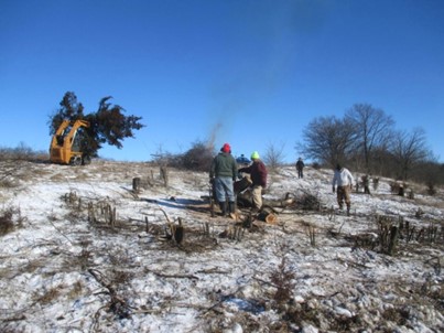
Photo credit: Jerry Newman
Work crews from Prairie Bluff Chapter removed most of the trees and brush from the western portion of the remnant prairie during the winter of 2015-16. Sawyers took out cedars, mulberries, cherries, apples, sumac and buckthorn, and then Nick Faessler hauled them to the burn pile with a skid steer. The chapter conducts periodic weed patrols in spring and summer; we collect seed in summer and fall.
Volunteers took out 531 feet of old fence line, woven wire and three tangled and buried strands of barbed wire, between Avon and Foslin. We cleared out dead trees and brush to get at the wire, which was sold to a recycler.
Long ago, Foslin Bluff was incorporated into the burn regime at Avon Ridge when Nathan Gingerich was managing Foslin for Applied Ecological Services. He alerted us to a spring burn there, and since then we have been burning small units to the east—part remnant, part CRP grassland—in a rotation that may take a few more years.
Usage Policies
Allowed:
- Hiking
- Birding
- Wildlife Photography
- Hunting
Not Allowed:
- Use of Motorized Vehicles or Bikes
- Camping
- Picnics
- Horseback Riding
Ownership History
Prairie Bluffer and past president Rob Baller first visited this site in the 1980s, with a neighbor Brad Paulson. The chapter was interested in purchasing the remnant prairie land since the chapter’s beginnings around 1987. The property consisted of parcels with three different owners. At that time, the land was sold to an Illinois couple and enrolled it in CRP. Again in 2004, the chapter attempted to raise money to buy some of the prairie, but the agreement fell apart. In 2014, chapter members noticed the land was once more for sale. This time our efforts were successful, and we purchased an acre of remnant prairie, a buffer in CRP and access, with a zoning change approved by Avon township.
Visits to Avon Ridge by Prairie Enthusiasts to view these blooming plants kept the property on our radar for decades until we were able to apply for the stewardship funds and raise the other half of the purchase price from our generous membership.
Avon Ridge was purchased with matching dollars from the Wisconsin Nelson-Knowles Stewardship Fund, so it is open to the public for hiking, hunting, birding and wildlife photography. Access is limited to foot traffic only. Camping, picnics and horseback riding are not allowed.
Management
Next to our one-acre remnant prairie is 14 acres of grasslands that is enrolled in the federal set-aside Conservation Reserve Program. This provides additional habitat for grassland birds. Our management of the prairie and planted grasslands will most likely include prescribed fire. A troublesome invasive plant, crown vetch, is present in a small area of both the CRP and prairie, but the entire property is remarkably free of weeds and brush.
Read more about the Prairie Bluff Chapter HERE.
Alexander Oak Savanna
Alexander Oak Savanna
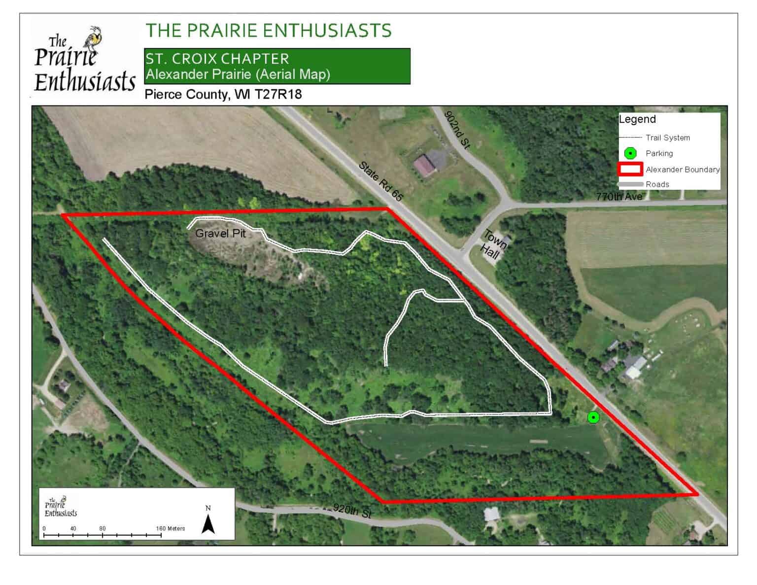
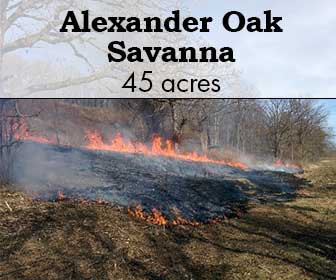
The 45-acre Alexander oak savanna is named for Dick and Joan Alexander who purchased the property in 1965. They lovingly owned and cared for the land for over 50 years, and in 2018, they generously sold the property through a bargain sale to The Prairie Enthusiasts.
Since 2000, the St. Croix Valley chapter has been cooperatively managing the property with the Alexanders. This effort has resulted in one of the largest restored dry-mesic prairie and oak savanna complexes in our chapter’s geographic area.
Portions of the 43 acres are easy to navigate, but getting to them can be a challenge. The maintained trails (fire breaks) can be occasionally steep.
SITE STEWARDS
ST. CROIX VALLEY CHAPTER
ACCESS & DIRECTIONS
The site is located in Pierce County, approximately four miles south of River Falls on state highway 65 and 0.2 miles south of the Town of River Falls Town Hall. There is a parking area access at the south end of the property.
Google Map
Description & Significance
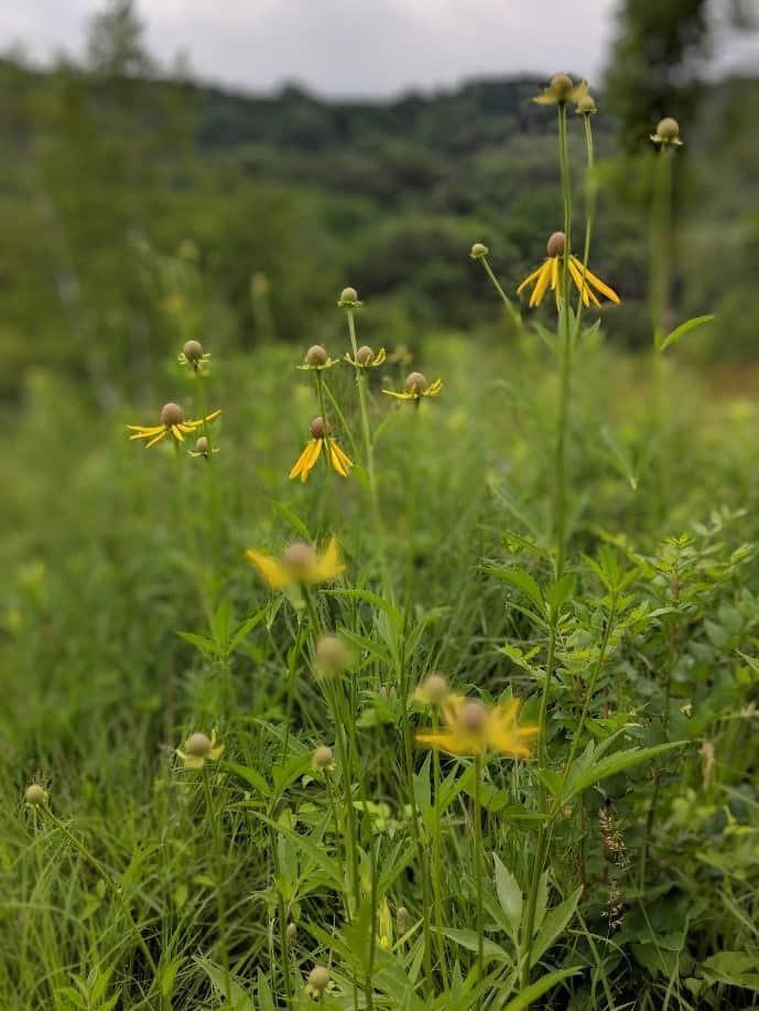
Alexander oak savanna is located in Pierce county, WI, within the Kinnickinnic River watershed and the Western Prairie Ecological Landscape (a Wisconsin DNR designation).
The dry prairie and oak savanna remnants found on the site are some of the best examples of these habitat types in the Western Prairie Ecological Landscape.
We have identified 120 native species on the site. Many species present are threatened or special concern in Wisconsin.
Some previously documented endangered and threatened species are noted, and with further management, may reappear.
Usage Policies
Allowed:
- Outdoor Recreation
- Hunting (for all species, no permit or reservation required)
- Trapping (for all species, no permit or reservation required)
Not Allowed:
- Collecting Plants, Seeds, Rocks or Animals without permission from The Prairie Enthusiasts
Ownership History
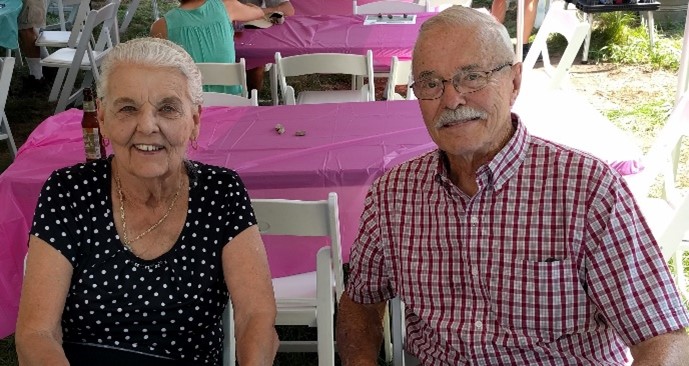
Dick and Joan Alexander purchased the property in 1965 and used it for decades as a resource for family activities, hunting and firewood gathering. The Wisconsin chapter of The Nature Conservancy recognized the resource significance of the site, and in 1985, secured a first right of refusal for the purchase of the property should it ever be offered for sale. This right was transferred to The Prairie Enthusiasts in 2003. In 2018, the Alexanders generously accepted an offer from The Prairie Enthusiasts for the purchase of the property, ensuring its continued resource recovery through land management.
Dick has actively participated in the work parties and burning over the years with both The Nature Conservancy and The Prairie Enthusiasts.
Management
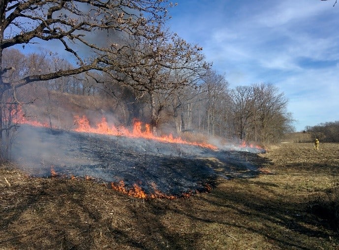
Prior to 2000, the site was managed by The Nature Conservancy through their volunteer site steward program. Since assuming management responsibility in 2000, The Prairie Enthusiasts’ efforts have focused on the removal of such invasive species as buckthorn, Siberian elm and red cedar. Regular prescribed burns are conducted in late winter or early spring. We have also re-introduced appropriate species native to this area by overseeding portions of the site with locally collected seed.
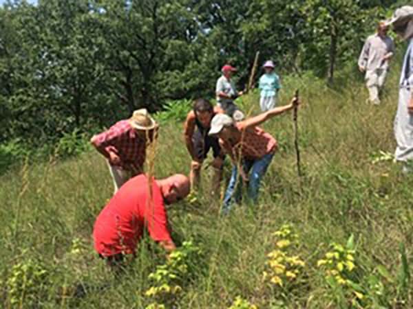
The restoration work has been done mainly by volunteers, but the chapter has also received land management grants from the U.S. Fish and Wildlife Service and the Wisconsin Department of Natural Resources to hire contractors to assist with this work. We have also been fortunate to have the assistance of many students from University of Wisconsin River Falls who have participated in a variety of site management activities. Throughout our management history of the site, Dick Alexander has shown his continued support for our efforts by participating in many of the on-site work parties.
