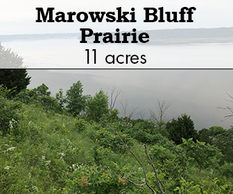
Skinner Prairie

Skinner Prairie

Photo credit: Jerry Newman

Skinner Prairie

Skinner Prairie is a hillside north of Monroe with a rich history. As early as 1828, John Skinner found lead deposits here in rock outcrops at the surface. U.S. surveyors noted Skinner’s diggings in May 1832 on the section line map marked today by power poles.

Pasque flower and lead plant still bloom in the thin soil at Skinner. The pits are easy to find, and the prairie is open for hiking and birding — thanks to a donation of 12.10 acres in 2018 to The Prairie Enthusiasts by Jim and Karen Freymiller.

There are no trails on the prairie, and is considered difficult to hike. 

SITE STEWARDS

PRAIRIE BLUFF CHAPTER

EMAIL

ACCESS & DIRECTIONS


Located in Green County, Wisconsin, between Monroe and Monticello off Highway 69. Go west on either Center Road or Cold Springs Road, which merge, and go west 1 mile to W5677 Center Road. Open every day. No hunting. From the west, Skinner Prairie is between County N and Hwy 69; take Buehler Road to W5677 Center Road. Park along Center Road & walk in past the mailbox for W5677 Center Road, the eastern driveway. Please do not block either driveway. Access to the prairies is on foot from the driveway, past the cemetery via the unpaved maintenance two-track. Ahead and to the right is Little Skinner, a small parcel that marks the northwest corner, and the junction of 4 sections (2, 3, 10, and 11) in Monroe Township. To get to the big prairie, proceed downhill to the south via a 50-foot wide access through old pasture. The low ground can be wet, as it drains this valley into Argus School Branch and Bushnell and Skinner Creeks. Big Skinner prairie is the northwest-facing hillside, with wooded ravines on both edges. Yellow signs mark our boundaries. The central prairie is steep and rocky, with deep pits.

Google Map

Description & Significance

Photo credit: Jerry Newman

In the early spring, look for pasque flowers and listen for meadowlarks. Find a population of prairie turnip (Pediomelum esculentum), a plant of Special Concern in Wisconsin, with optimal viewing from early June to late August. See kingbirds hunt insects from the hawthorns. Practice your ID skills: find bluestems, dropseed and side oats grama. The autumn months bring chapter seed collecting parties to Skinner Prairie for purple prairie clover and coreopsis. Notice how the prickly ash and hawthorns survived years of grazing to form large native colonies.

Ownership History

Photo credit: Jerry Newman

In 1976, the Wisconsin Department of Natural Resources published a Natural Area Inventory of Green County, written by Gary A. Birch with the assistance of Gary Eldred, Reynold Zeller and Clifford Germain. One of their sites was Sager Prairie, 35 acres of hillside in the Town of Monroe: “A relatively large dry prairie dominated by side-oat grama and little bluestem. There are more than 40 prairie species present.”

Local historian and prairie enthusiast Gary Felder visited Skinner Diggings one spring day in 1987, and found pasque flowers “in numbers that stagger the imagination,” with thousands of the early spring wildflowers covering the entire remnant hillside “like a blanket” spreading over the old mine shafts and rock piles. He wrote an article for the December 1988, newsletter of the Wisconsin Prairie Enthusiasts about Skinner Prairie:

“It is not very often that an individual is fortunate enough to find a natural area that satisfies the interests of two hobbies. In my case, local pre-settlement and early pioneer history coupled with the enjoyment of Green County’s remnant prairie sites. Skinner Prairie fits these criteria like no other site in Green County.”

In 1996, Gary Felder tried to find a buyer for Skinner Prairie — 40 acres of remnant prairie – that was subdivided into three home lots by the owner and listed with a local realtor. All the likely conservation buyers had other projects at the time, so all three lots now have houses. One of the buyers was Jim and Karen Freymiller, who built a house off Center Road, away from the prairie hillside that was their backyard acreage. One day Felder knocked on their door, and invited the couple to explore the prairie and diggings with him. Jim grew up in Boscobel and trained bird dogs, so he quickly caught Gary’s enthusiasm for native landscapes. In addition, this one had a chapter from Green County’s early mining history.

Management

Volunteers from the Prairie Bluff Chapter have thinned out sumac and prickly ash on all sides. We mow weeds every summer to prevent parsnip, sweet clover and wild carrot from going to seed. We collect seeds here: side-oats grama, little bluestem and dropseed. Skinner Prairie, unburned for 100 years, got weedy and brushy after cattle stopped grazing about 70 years ago. Currently our fire regime is to burn some of this hillside, every five years (2013, 2018, 2023), although we burned a quarter-acre of a west side remnant for dropseed production in 2019.

Muralt Bluff Prairie

Muralt Bluff Prairie

Photo credit: Jerry Newman

Muralt Bluff Prairie

Muralt Bluff Prairie is the largest preserve managed by the Prairie Bluff Chapter, and a site with special significance for The Prairie Enthusiasts who consider it the place where our efforts for prairie preservation began some 40 years ago. 

Muralt Bluff and additions to the propertiy are dry prairies on a bluff with a thin limestone cap over sloping sandstone sides. Federal and state listed species that have been observed here:  Bell’s vireo, regal fritillary, Ottoe skipper, one-flowered broomrape, prairie dandelion, kittentails and Hill’s thistle.

This is considered difficult to hike as the trail is long and quite steep.  

SITE STEWARDS

TOM MITCHELL

EMAIL

ACCESS & DIRECTIONS


The parking lot for Muralt Bluff Prairie is located near W2635 County F, between Monticello and Albany. Access is by foot only up the steep bluff, and a trail will take you to the farthest west end. You can return by following the firebreak along the south and east edges.

Google Map

Description & Significance

Muralt Bluff and Muralt South are dry prairies on a bluff with a thin limestone cap over sloping sandstone sides.  Outcrops of both rocks are present on the sites.  Erratic boulders from an earlier episode of glaciation are present.  The last advance of the ice sheet stopped about 10 miles to the northeast 16,000 to 18,000 years ago, but a pro-glacial lake, named Glacial Lake Broadhead by Wisconsin geologists, backed up the valleys of Sylvester and Searles Creeks and the Sugar and Little Sugar Rivers, flooding the broad valley to the north of Muralt Bluff.  The elevation is above the 1,000 foot contour and views of Blue Mounds, some 40 miles distant, are possible.

Natural History

Best times to visit to see wildflowers are spring and fall.  In early May, there is a large population of prairie smoke on the northwest bluff, along with kittentails, shooting stars, puccoon, violets, sand cress and pasque flowers.  Later in autumn you can see all the tall grasses, nine kinds of asters, five species of goldenrods, gentians and blazing stars.  Federal and state listed species that have been observed here:  Bell’s vireo, regal fritillary, Ottoe skipper, one-flowered broomrape, prairie dandelion, kittentails and Hill’s thistle.   But changes in the surrounding land use have reduced the available grassland habitat from hundreds of acres in the 1970s to only the Muralt footprint today

On July 20, 2014, a visitor to Muralt Bluff Prairie posted to the Southern Wisconsin Butterfly Association (SWBA) website a tally of the more than 100 butterflies that he spotted:  including giant swallowtail, eastern tiger swallowtails, clouded sulphurs, coral hairstreaks, summer azures, great spangled fritillaries, pearl crescents, question marks, eastern comma, mourning cloak, American lady, red admirals, red-spotted purples, common wood nymphs, monarchs, northern broken-dash and Delaware skipper.

Usage Policies

Allowed:

  • Hiking
  • Bird Watching
  • Dogs (must be on a leash during bird breeding season from May-July)
  • Hunting (all legal species; no permit or reservation required)

    Not Allowed:

    • Collecting plants, rocks or animals

    Ownership History

    During the early 1970s Albany natives Gary Eldred and John Ochsner independently discovered this patch of unusual tall grasses and flowers.  The next spring in April of 1975, together with Jonathan Wilde, Tim Hammerli and others, they dropped a match in the southeast corner and watched the fire follow the wind across the field to the north.  Their suppression  tools – snow shovels and burlap bags — proved inadequate to slow or stop the fire.  The Albany Fire Department responded to reports of a wild fire, but they were unable to get their trucks up the bluff, so everyone stood and watched as the fire eventually ran out of fuel.  Many cedar trees were scorched, the ground was blackened.  But that summer the bloom of flowers – long suppressed by lack of fire – was impressive enough that the Green County Board of Supervisors was persuaded to buy the acreage.

    Muralt Bluff was dedicated as a Wisconsin State Natural Area in 1977.  In 1981 the county purchased an additional 12 acres – South Muralt – with the help of The Nature Conservancy.  The county deeded Muralt Bluff (62 acres) and South Muralt to The Prairie Enthusiasts in September, 2013.  With adjacent Iltis Savanna this is a 95-acre mosaic of prairie, savanna and woodland.  A fourth parcel, Stauffacher Prairie, which is located a mile away across from Gap Church on Highway 59, is considered by the DNR to be part of the Muralt Bluff  SNA although that land is owned by the State of Wisconsin.

    Management

    Management efforts by Prairie Bluff Chapter in the last few years have expanded the prairie by removing colonies of aspen, sumac, dogwood, prickly ash and honeysuckle that had invaded from the fence lines and wooded edges to smother and shade out the native plants and grasses.

    Iltis Savanna

    Iltis Savanna

    Photo credit: Jerry Newman

    Iltis Savanna

    Iltis Savanna is a 21.5 acre complex of woods, savanna and dry prairie that is adjacent to Muralt Bluff in the southeast quarter of Section 25 of Mt. Pleasant Township in Green County, Wisconsin.  It was purchased by The Prairie Enthusiasts in December, 1999, and it is named for Dr. Hugh H. Iltis, eminent Professor of Botany at the University of Wisconsin – Madison and Director of the UW Herbarium from 1955 to 1993.

    This is a challenging hike as it’s long and steep; there are no trails.

    SITE STEWARDS

    PRAIRIE BLUFF CHAPTER

    EMAIL

    ACCESS & DIRECTIONS

    Public access to Iltis Savanna is from the parking lot of Muralt Bluff, next to W2635 County F, between Monticello and Albany.  Take the hiking path up the steep bluff to the top of the hill, and then walk east toward the oak trees.

    Google Map

    Description & Significance

    Iltis Savanna was the most degraded of our sites upon acquisition, and it remains the most challenging. An aerial photo from 1939 shows a mostly open landscape, with so few open-grown oaks that they can be counted.  Our fire regime has promoted the emergence of young oaks, to ensure that this savanna will endure into the 21st century. After significant efforts by members of the Prairie Bluff Chapter, native species are returning.

    Notable Plants On This Site:

    • Various specis of Rubus
    • joe-pye weed (Eutrochium maculatum)
    • hyssop
    • shooting star
    • bush clover
    • various asters & goldenrod
    • showy orchid (Galearis spectabilis)
    • Indian pipe (Monotropa uniflora)
    • little bluestem (Schizachyrium scoparium)
    • prairie dropseed (Sporobolus heterolepis)
    • lead plant (Amorpha canescens)
    • Hill’s thistle (Cirsium pumilum var. hillii)
    • wood betony (Pedicularis canadensis)
    • bird’s foot violet (Viola pedata)
    • prairie violet (Viola pedatifida)
    • Ohio spiderwort (Tradescantia ohiensis)
    • violet wood sorrel (Oxalis violacea)

    Usage Policies

    Allowed:

    • Outdoor Recreation
    • Hunting (for all species, no permit or reservation required)

      Management

      South of these oaks is a 4-acre former agricultural crop field that included a large sumac clone and a honey locust grove when we re-started active management in 2009.  We used timed — twice in late summer — mowing to reduce the sumac to manageable numbers, which we then eliminated one-by-one.  We hired a contractor in 2016 to uproot the locusts, which we piled and burned.  See our Facebook page for a video, “One more acre for prairie.”  We began planting this field to prairie in 2014 with seeds we collected at our other sites, with three subsequent plantings.  Site preparation has been difficult due to deep-rooted brome grass and a seed bank of red clover.

      As you walk east along the north edge of this field, the unmanaged woodlot to your left in an example of what happens when grazing animals are removed from a farmstead that has a few oak trees.  Walnuts, hickories, cherries, cedars and basswoods eventually grow up, and the understory is filled in with raspberries, blackberries, dogwood, sumac, prickly ash and honeysuckle … lots of honeysuckle.

      The core of Iltis Savanna is a mature bur, white and red oak savanna that occupies a north-south ridge with a thin limestone cap over sandstone.  The oak structure remains, but 100 years of grazing by cows, pigs and horses eliminated almost all the floral element underneath.  Some sedges and spring ephemerals like trout lily were all that remained under the oaks.  Garlic mustard was a problem that we’ve controlled with prescribed fire.  We thinned out the northern portion with a basswood harvest.  Various species of Rubus quickly filled these open spaces, while hog peanut moved in to cover the south end with a blanket of vines.  But slowly, in the past decade, we’ve seen the natives begin to reclaim the savanna: joe pye weed, hyssop, shooting stars, bush clover, asters and goldenrods.  Showy orchids and Indian pipe can be seen most years.

      A keen eye will make out a former farm dump on the side of the bluff, halfway down the hill.  For ten years the chapter worked to clean out the trash: recycling fence wire and hauling off parts of cars, trucks, farm equipment, household appliances, toys, cans, bottles and broken glass.  Finally, in 2012, we hired a contractor to bury what was left of the dump.  There was not enough topsoil to cover it all, so a few truckloads of fill were brought in.  We began to plant dry prairie species — little bluestem, dropseed and lead plant — into the thin soil.  Hill’s thistle and wood betony are now common in this planting.  But the fill contained reed canary grass and the sweet clovers, which were problematic in the lower portion.

      Below the dump planting is a steep west-facing bluff.  Restoration started at the top, clearing cedars and brush and seeding in native grasses and forbs.  Between this bluff and the savanna is a strip of dry prairie dominated by little bluestem, with both bird’s foot and prairie violet, spiderwort, violet wood sorrel, asters, goldenrods and blazing stars.

      Double Oaks Savanna

      Double Oaks Savanna

      Double Oaks Savanna

      Double Oaks Savanna was gifted to TPE by Alice and Walter Mirk in 2012. The 23 acres contains remnant and restored prairie, oak savanna and oak woodland. The rugged terrain is home to a number of rare species including purple milkweed (Asclepias purpurascens), prairie Indian plantain (Arnoglossum plantagineum), jeweled shooting star (Dodecatheon amethystinum), pickerel frog (Lithobates palustris), and prairie ring-necked snake (Diadophis punctatus arnyi). 

      SITE STEWARDS

      SOUTHWEST CHAPTER


      EMAIL

      ACCESS & DIRECTIONS


      From the east, go to the intersection of Highway 133 and County Road C west of Woodman. Proceed west on County Road C 4.7 miles to the rock quarry on the right., where we will congregate. From the west, go to the intersection of Highway 18 and County Road C, a few miles east of Prairie du Chien. Drive east on County C for 7.8 miles. Just past the settlement of Millville you will come to the rock quarry on the left.

      Google Map

      Usage Policies

      Allowed:

      • Outdoor Recreation
      • Hunting (for all species, no permit or reservation required)

      Not Allowed: